How to See Godafoss Comfortably in Every Season

Godafoss is easy to reach, but knowing how to see Godafoss comfortably is what turns a quick roadside stop into a genuinely enjoyable experience. The waterfall is powerful, open to the elements, and surprisingly different from one season to the next. A little planning helps you avoid the common mistakes: arriving underdressed, choosing the wrong path for your mobility, or rushing through one of North Iceland’s most memorable landscapes.

The good news is that you do not need to be an experienced hiker to enjoy Godafoss. You do need sensible footwear, enough time to walk at your own pace, and a plan that suits the weather rather than fighting it.

Start by choosing the side that suits you

Godafoss has viewing areas on both sides of the Skjálfandafljót River. Each gives you a different angle, and the best choice depends on what feels comfortable for you that day.

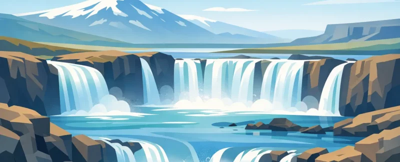
The west side is the most familiar stop for many visitors. It is close to services and parking, and the walk to the viewpoints is relatively short. From here, you can look across the wide curve of the waterfall and appreciate its scale. This side is a sensible choice for travelers with limited time, families with young children, or anyone who prefers to keep walking distances modest.

The east side offers a closer, more dramatic perspective on sections of the falls. It is often especially rewarding for photographers and visitors who want to spend more time exploring. The paths can feel less straightforward in poor weather, however, and there may be uneven or slippery ground near the river. If balance is a concern, there is no prize for getting closest to the water. The wider viewpoints are beautiful too.

If you have the time and conditions are good, seeing both sides gives the fullest experience. Allow yourself time to return to the vehicle, warm up if necessary, and move at a relaxed pace. Godafoss is not a place that improves when treated like a race.

How to see Godafoss comfortably in changing weather

Weather shapes every visit here. A calm summer afternoon can make the walk feel easy, while the same paths in rain, wind, snow, or ice require more care. North Iceland weather also changes quickly, so check conditions before leaving and look again before stepping out of the car.

Wind is often the detail visitors underestimate. At Godafoss, wind can make the air feel much colder than the temperature suggests, especially when spray is blowing from the waterfall. A waterproof outer layer with a hood is more useful than an umbrella, which tends to have a short and unhappy life in Icelandic wind.

Dress in layers rather than relying on one heavy coat. A warm base layer, insulating mid-layer, and windproof, waterproof shell let you adjust as needed. Gloves are useful well beyond winter because hands get cold quickly when you are holding a camera or phone. A warm hat is equally helpful, particularly if you plan to stand still and watch the falls for a while.

Footwear matters more than looking outdoorsy. Wear shoes or hiking boots with good grip, preferably waterproof. In summer, the paths may be damp and muddy after rain. In winter, packed snow and ice can turn short walks into careful ones. Lightweight traction cleats can make a major difference in icy conditions, but they do not replace common sense. Keep well back from edges, take small steps, and accept that a slower walk is the right walk.

Give yourself more time than the map suggests

From the main road, Godafoss looks like a brief stop. For some travelers, it is. But comfort comes from having room to pause, take photographs, use the facilities, and wait for a gust of rain or a busy group to pass.

Plan on at least 45 minutes for a relaxed look from one side. An hour to 90 minutes is better if you want to see both sides, walk carefully in winter, or simply enjoy the river without checking your watch. Those traveling with children, older relatives, or anyone recovering from a long drive should be generous with time. The walk itself may be short, but changing layers, navigating uneven ground, and taking breaks all add up.

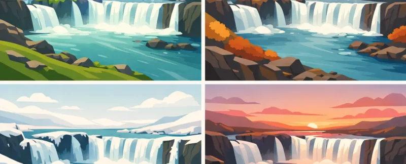
Early morning and later evening are usually the most peaceful times in the brighter months. The light is softer, parking is often easier, and the waterfall feels less like a checkpoint on a busy route. Midday can still be lovely, particularly on a clear day, but expect more visitors during the main travel season.

In winter, daylight is the real timetable. Do not leave your visit until late afternoon unless you are comfortable driving and walking in darkness. Blue-hour light around the waterfall can be beautiful, but ice, reduced visibility, and a cold wind make it better suited to travelers who are properly equipped and unhurried.

Make parking and facilities part of the plan

Godafoss is directly accessible from the Ring Road, which makes it convenient but also busy at peak times. Use designated parking areas and take a moment after parking to organize what you need. Put on your waterproof layer, bring your camera, and leave loose items secured in the vehicle. Chasing a hat across a windy parking lot is not the Icelandic adventure most people came for.

Facilities are available near the main visitor area, but availability and opening arrangements can vary by season. Use the restroom before starting your walk rather than assuming you can quickly return. If you are traveling with children or someone who needs regular breaks, this small bit of planning makes the stop much easier.

Do not expect a long, sheltered promenade right beside the waterfall. The beauty of Godafoss comes with exposure to real weather and natural ground. Visitors with limited mobility can still enjoy worthwhile views, especially from the more accessible areas near parking, but should choose their route conservatively and avoid trying to match the itinerary of faster walkers.

Visit with children, older travelers, and different comfort needs

Godafoss works well for mixed groups when the day is planned around the slowest walker, not the fastest one. Keep children close near the river, even when paths look broad and dry. The current is powerful, rocks can be slick, and conditions can change quickly. Give them clear boundaries before leaving the car.

For older travelers, the key questions are usually wind, surface conditions, and distance rather than fitness alone. A short walk on icy ground can be more tiring than a longer walk on dry pavement. Bring a walking pole if it helps with confidence, allow time for rests, and do not hesitate to enjoy the view from a comfortable stopping point.

Photography adds another consideration. It is easy to focus on a composition and forget the cold, spray, or people moving around you. Keep straps on cameras and phones, wipe lenses regularly, and avoid backing up toward the river while looking through a viewfinder. In low light, a tripod can be useful, but set it up well away from walking paths and never where you need to balance near an edge.

Let local conditions decide the day

There is no single perfect way to visit Godafoss. On a bright, calm summer day, you may happily walk both sides and linger by the river. During winter weather, the comfortable choice may be a shorter visit from a well-cleared viewpoint. Both are valid experiences.

Road conditions should also guide your decisions. The drive may be straightforward, yet winter storms, high winds, and icy roads can change that quickly. Travelers unfamiliar with Icelandic winter driving often enjoy the day more when they leave the driving and weather judgment to a certified local guide. On a private outing with Kip, the pace can be adjusted around your group, the conditions, and the amount of walking that feels right for you.

Godafoss has been part of this landscape for centuries. Give it a little time, dress for the day you actually have, and let comfort make room for the view.
Posted in kip

8 Best Scenic Drives in North Iceland for Visitors

The best scenic drives in North Iceland are not always the ones that cover the most miles. A good day here may mean a slow road beside Lake Mývatn, a detour for a waterfall you almost missed, or a long pause while Arctic terns work the shoreline. The landscape changes quickly, and so do the conditions, which is why choosing the right route for your season and confidence behind the wheel matters.

North Iceland rewards travelers who leave room in the plan. Some routes are easy, paved, and suitable for a relaxed family day. Others lead into highland country where a capable vehicle, weather awareness, and experience are essential. Here are eight drives worth building time around.

1. The Lake Mývatn Circuit

The roads around Lake Mývatn make one of the most varied scenic drives in the region without requiring a demanding day behind the wheel. In a relatively compact area, you can pass lava fields, pseudocraters, steaming geothermal ground, quiet wetlands, and broad views over the lake.

Drive slowly here. The appeal is not the road itself but the frequent stops: Skútustaðagígar pseudocraters, Dimmuborgir lava formations, Hverir geothermal area, and the Krafla region all have very different character. In summer, the light can stay soft late into the evening. In winter, this route can be beautiful but requires more care, as snow, ice, wind, and reduced visibility can change the day quickly.

For travelers based in Mývatn, Laugar, or Akureyri, this is often the best choice when you want a full day of scenery without long transfers.

2. The Diamond Circle to Dettifoss and Ásbyrgi

The Diamond Circle is a classic for a reason. It combines powerful waterfalls, a canyon shaped by glacial floods, a horseshoe-shaped forested valley, and coastal views in one ambitious day. The drive links the Mývatn area with Dettifoss, Selfoss, Húsavík, and Ásbyrgi, though the exact order should depend on your starting point, the weather, and how much walking you want to do.

Dettifoss is the dramatic center of the route. Its volume and force are difficult to understand until you stand near it, feeling spray in the air and the low vibration beneath your feet. From there, the road toward Ásbyrgi shifts the mood completely. The cliffs around the canyon feel sheltered and unexpectedly green, particularly in summer.

This is a long sightseeing day, not a quick loop. It works best when you choose a few stops you genuinely want to experience rather than racing through every marked attraction.

3. Route 85 Along the Tjörnes Peninsula

For open ocean, wide skies, and a quieter feel, take Route 85 around the Tjörnes Peninsula. This road runs north from Húsavík toward Ásbyrgi, following a coastline where the geology is visible in the layered cliffs and the sea is never far away.

The drive is especially rewarding for birdwatchers and photographers. In the right season, you may see seabirds along the cliffs, and the changing weather can make the water look almost metallic. The road is generally straightforward, but winds can be strong and fog can roll in quickly near the coast.

This route is a fine alternative to retracing the same road after a visit to Húsavík or Dettifoss. Give yourself time to stop safely where permitted, rather than treating it only as a connection between larger sights.

4. Route 82 from Akureyri to Hjalteyri and Dalvík

North of Akureyri, Route 82 follows Eyjafjörður, Iceland’s longest fjord. It is an easy, paved drive with a very different character from the volcanic interior. The mountains rise sharply from the water, fishing villages appear along the shore, and the view changes with every bend in the fjord.

Hjalteyri is worth a gentle detour for its old herring-era atmosphere and peaceful harbor. Continue toward Dalvík for larger mountain views and a sense of everyday life in a working north Iceland town. On clear days, the fjord can be remarkably calm. On stormy days, it is a good reminder that this coast is still shaped by the North Atlantic.

It is a practical half-day drive from Akureyri, particularly for travelers who prefer scenic roads with simple logistics and cafés or services nearby.

5. Öxnadalsheiði and the Western Approach to Akureyri

If you are arriving in North Iceland on Route 1 from the west, do not treat Öxnadalsheiði as merely a pass to get through. This stretch between Skagafjörður and Eyjafjörður offers broad valleys, steep mountain slopes, and a fine introduction to the scale of the north.

The scenery is most impressive when low clouds hang around the peaks or when autumn colors begin to show in the valleys. It is also a route where weather can make a meaningful difference. Winter driving may involve icy pavement, drifting snow, and sudden closures, while high winds are possible in every season.

The reward is a gradual arrival into the Akureyri area, with the landscape opening and narrowing in turns. If conditions are poor, there is no shame in changing plans. In Iceland, the sensible route is always the scenic one when it gets you there safely.

6. Route 1 East of Mývatn Toward Möðrudalur

East of Lake Mývatn, Route 1 enters a more spacious and exposed landscape. The road climbs through volcanic highland margins where vegetation thins out and the horizon feels unusually far away. This is not the place for a packed schedule. It is the place for travelers who enjoy emptiness, big weather, and the feeling of being well away from town.

The route toward Möðrudalur is particularly atmospheric in clear conditions, when distant mountains and black volcanic ground seem to go on forever. It can also be challenging in wind, snow, or fog, and services are limited compared with the areas around Akureyri and Mývatn.

Keep fuel levels healthy, check conditions before leaving, and expect the drive to take longer than a map suggests. The scenery is subtle rather than flashy, but it stays with people.

7. Flateyjardalur for a Remote Valley Day

Flateyjardalur is for visitors who want North Iceland beyond the familiar highlights. The valley north of the Mývatn region has a remote, historical feeling, with mountain slopes, old farm landscapes, and very little traffic. It is not a route to take casually in a standard rental car without checking current road conditions.

Access and road quality vary by season. Some approaches are rough, and a suitable four-wheel-drive vehicle may be needed. This is exactly the kind of drive where local knowledge pays off: the best route can change after rain, snowmelt, or road work, and the day should be planned around the conditions rather than a fixed itinerary.

For guests who want quiet photography, local stories, and a true sense of distance from the main road, it can be one of the most memorable days in the north.

8. Askja and the Highland Roads

Askja is among the great scenic drives of North Iceland, but it is not a normal road trip. The journey crosses remote highland terrain toward a volcanic caldera, passing black sand, wide gravel plains, and landscapes that feel almost lunar. The destination is extraordinary, but the drive is a serious part of the experience.

Highland F-roads are only open seasonally and require a proper four-wheel-drive vehicle. River crossings may be involved, and their depth can change quickly. Rental agreements, insurance restrictions, weather, snow cover, and your own river-crossing experience all deserve careful consideration. A two-wheel-drive vehicle does not belong on these roads.

If Askja is high on your list but you do not want the responsibility of a highland drive, a private guided day can make the experience far more relaxed. At Kip, Kristinn plans these kinds of days around current conditions and the interests of the people in the vehicle, rather than forcing a group into a fixed schedule.

How to Choose Among the Best Scenic Drives in North Iceland

The right drive depends less on what looks best in a photo and more on how you want to travel. Choose Lake Mývatn or Eyjafjörður for easy roads and flexible stopping. Choose the Diamond Circle for major natural landmarks and a full day out. Choose Tjörnes or the road east of Mývatn when you enjoy coastal or open-country solitude. Save Flateyjardalur and Askja for days when conditions, vehicle capability, and experience align.

Before any longer drive, check the official road and weather information, fill the tank when you have the chance, and bring warm layers even in summer. Four habits make a noticeable difference:

  • Let weather and road reports decide the final route, especially from October through April.
  • Build extra time into every day for photo stops, sheep on the road, and changing visibility.
  • Stay on marked roads and paths. Fragile moss and volcanic ground can take decades to recover.
  • Turn back when conditions worsen. A missed viewpoint is never worth a risky drive.

A scenic drive in North Iceland is at its best when there is time to notice what is between the famous stops: a patch of steam rising from lava, a farmhouse beneath a mountain, or a road disappearing into a valley you had not planned to love.

Posted in kip

Iceland Shoulder Season Travel Made Simple

A waterfall with no one standing in front of it, low autumn light across the lava fields, and enough time to stop when something catches your eye: that is the appeal of Iceland shoulder season travel. It can be one of the best times to visit North Iceland, but it is not simply summer with fewer people. Weather changes faster, roads may close without much warning, and daylight shapes every plan. Travelers who leave room for those realities are often rewarded with a more personal experience of the country.

Iceland Shoulder Season Travel in North Iceland

In Iceland, shoulder season generally means spring, from about April through May, and fall, from September through October. The exact experience changes greatly within those months. Early April can still feel fully wintery in the north, while late May brings bright evenings, nesting birds, and roads that are gradually becoming easier to travel. September can offer green and gold landscapes with reasonable daylight, while October is darker, colder, and more likely to bring snow at higher elevations.

The advantage is not just quieter parking lots. The landscape feels different when it is not at its busiest. Around Lake Mývatn, for example, mist can sit over the water on a cool morning, geothermal areas steam more dramatically in cold air, and there is often time to linger at a viewpoint rather than follow a fixed bus schedule.

That said, shoulder season is not a bargain version of a summer trip. Some highland routes remain closed in spring and can close early in fall. A favorite restaurant or small local service may keep shorter hours. The right approach is to choose the season for what it is: more changeable, quieter, and often wonderfully atmospheric.

Choose Spring or Fall for the Experience You Want

Spring is a good fit for travelers who want increasing daylight and a sense of Iceland waking up after winter. Snow can still frame the mountains and cover parts of the countryside, while lower elevations begin to show color. Waterfalls are powerful as thawing snow feeds the rivers. Birdlife is also a major reason to visit, particularly around wetlands and coastal areas.

The compromise is that spring road conditions can be unpredictable. Gravel roads may be soft after thawing, and a bright morning can turn windy or snowy later in the day. If your dream itinerary depends on remote roads or the interior highlands, spring is not the time to assume access.

Fall is often especially appealing to photographers and travelers who enjoy moody weather. The light becomes softer and lower, the summer crowds thin, and clear nights can bring a chance of seeing the Northern Lights. September usually gives a comfortable balance of daylight and evening darkness. By October, aurora opportunities improve, but a shorter day requires more careful timing.

Fall weather can also be dramatic. Wind is often the deciding factor rather than temperature alone. A day that looks mild on paper may feel very cold near a waterfall, on an exposed coast, or while waiting outside after dark for the lights.

Let Road and Weather Conditions Set the Pace

A good North Iceland day does not begin with a rigid list of stops. It begins by checking the forecast, wind, road conditions, and visibility. Those details matter more in shoulder season because conditions can be very different only a few miles apart. A road near Akureyri may be clear while mountain roads farther east have snow, ice, or poor visibility.

Self-driving visitors should be conservative. Icelandic roads are not difficult because they are exotic. They become difficult when wind, darkness, ice, loose gravel, or sudden weather are added to an unfamiliar route. Never treat a closure as a suggestion, and do not make a highland plan based on an old social media post or a sunny forecast from the day before.

This does not mean staying indoors whenever clouds appear. North Iceland has plenty to offer in mixed weather. The Lake Mývatn area has geothermal landscapes, lava formations, waterfalls, and broad views that can all work beautifully with shifting light. On the Diamond Circle, a flexible route may mean adjusting the order of stops, choosing sheltered viewpoints, or spending more time where conditions are best.

A local guide can be particularly useful here, not because every day needs to be complicated, but because knowing when to change direction is valuable. Sometimes the best decision is to skip an exposed stop and take a quieter valley road. Sometimes waiting 30 minutes lets a rain shower move through and gives you the view you hoped for.

Plan Iceland Shoulder Season Travel Around Daylight

Daylight is generous in May and still very workable through much of September. It shrinks quickly in October, especially when weather slows driving. Rather than trying to see every famous place in one day, choose a route with a few meaningful stops and room for detours.

For a private day tour, that flexibility can make the day feel less like a checklist. You might spend extra time photographing Goðafoss in changing light, take a short walk where the wind is calm, or stop for coffee and a local story before continuing. Families may want more breaks. Serious photographers may want to begin early or stay late. Travelers who are less comfortable walking on uneven ground may prefer to focus on scenic locations with easy access. A thoughtful plan can accommodate all of these without rushing.

If Northern Lights are part of the trip, keep your daytime expectations realistic. An aurora outing works best when it is treated as a weather-dependent evening possibility, not a guaranteed event after an exhausting full day. Clear skies matter most, and the best viewing location may change with the forecast.

Pack for the Conditions, Not the Calendar

Shoulder season packing is simple if you think in layers. A warm insulating layer, waterproof outer shell, hat, gloves, and sturdy waterproof footwear will serve you well in both spring and fall. Windproof clothing is especially useful. An umbrella is rarely much help when the wind picks up.

Bring a small daypack so you can add or remove layers easily. Sunglasses are useful even on cold days, particularly when sunlight reflects off snow or water. A reusable water bottle, snacks, and a phone battery pack are sensible for longer days in rural areas.

Do not rely on a heavy winter coat alone. The best clothing system is one you can adjust when you move from a warm vehicle to a windy overlook, then onto a short walk beside a waterfall. Waterproof shoes matter more than many visitors expect. Trails can be wet, muddy, icy, or all three in the same week.

When a Private Guide Makes the Difference

Shoulder season rewards people who can adapt, and that is where a private guide offers real comfort. You do not have to spend the morning decoding road reports or wondering whether a distant cloud bank will affect your route. You can focus on the experience while someone who knows the area considers the practical details.

For travelers based in Akureyri, Laugar, or the Mývatn region, a tailor-made day can be built around the conditions and your interests. One group may want geology and geothermal landscapes. Another may be traveling with children and want a relaxed day with short walks. A couple may be hoping for quiet viewpoints and time for photographs. None of those needs require the same route.

At Kip, that local knowledge comes from guiding in this region through changing seasons, not from following one fixed itinerary. The goal is not to pretend Icelandic weather can be controlled. It is to make good choices within it and help guests feel safe, welcome, and unhurried.

The most memorable shoulder-season days are often the ones that leave a little space for surprise: a patch of sunlight on a mountain, a rainbow above a waterfall, fresh snow on black lava, or a quiet road that leads somewhere you had not planned to stop. Come prepared, keep your schedule flexible, and let North Iceland show you what it has that day.

Posted in kip

How to Plan an Askja Daytrip From North Iceland

Askja is not the kind of place to squeeze between breakfast and dinner plans. It is a full highland day: long gravel roads, wide open desert, changing weather, and a volcanic landscape that makes the journey feel as memorable as the destination. Knowing how to plan an Askja daytrip well means allowing enough time, choosing the right vehicle and route, and leaving room for Iceland to change the plan.

For many visitors, Askja is one of the great days in North Iceland. The sight of the vast caldera, the blue water of Víti crater, and the black volcanic country around Dyngjufjöll can feel almost unreal. It is also remote. That remoteness is exactly why a little preparation makes such a difference.

Start With the Right Expectations

An Askja daytrip is usually a long one. From the Mývatn area, Laugar, or Akureyri, expect a full day in the vehicle and the highlands, often 10 to 14 hours door to door depending on road conditions, your starting point, stops along the way, and how much walking you would like to do.

This is not a complaint. The drive is part of the experience. The route passes lava fields, mountain roads, rivers, and immense empty spaces where it is easy to understand why Icelanders still speak of the interior with respect. But travelers who expect a quick sightseeing stop can be disappointed. Plan Askja as the main event of the day, not an add-on.

The season matters just as much as the distance. Highland roads are normally open only in summer, and opening dates vary from year to year. Snow can linger near Askja long after lower roads are clear. Even in midsummer, cold wind, fog, rain, or fresh snow are all possible. A sunny forecast in town does not guarantee a sunny caldera.

How to Plan an Askja Daytrip Around Road Conditions

The first practical question is not “What time should I leave?” It is “Which roads are open, and what are they like today?” Roads into Askja are mountain roads, often called F-roads. They can be rough, slow, and subject to sudden closures after weather or river changes.

A capable 4×4 is essential for the normal highland approaches. Some routes involve river crossings, while others may be less demanding but still require real ground clearance, patient driving, and confidence on uneven surfaces. Conditions change too much for a route description from last week, or even yesterday, to be treated as a promise.

Before setting out, confirm the current road status and ask specifically about river crossings, visibility, and snow near the Askja parking area. If a road is closed, do not drive around a barrier or assume that a rental vehicle can handle it because another vehicle has passed. Highland rescue is not a casual inconvenience, and off-road driving damages a landscape that takes centuries to recover.

If you are unfamiliar with F-roads, a private guided trip is often the more relaxed choice. You can spend your attention on the landscape instead of reading the road, judging water levels, and wondering whether the next rough section is normal. With Kip, the day can also be adapted to the actual conditions rather than following a fixed timetable that no longer makes sense.

Choose a Route for the Day You Have

There is more than one way toward Askja, and the best approach depends on the roads, weather, and your group. The F88 route is famous for its rugged character and river crossings. Other approaches can be more suitable on certain days, but they are still highland roads, not regular highways.

A good plan does not insist on one route for the sake of a map. It considers who is traveling. A family with young children, guests who prefer a smoother ride, serious photographers hoping for late-day light, and confident hikers may all benefit from different timing and choices. In the highlands, flexibility is not a luxury. It is sensible travel.

Give Yourself Time at Askja

Once you reach the main parking area, Askja is still not simply a view from the windshield. The walk toward Víti and the caldera is relatively short for many visitors, but the surface is uneven and exposed. In clear conditions, allow time to walk slowly, take photographs, and absorb the scale of the place.

The walk is commonly around 1.5 miles round trip, depending on where you begin and which viewpoints you choose. It is not technically difficult for most reasonably mobile travelers, but wind and cold can make it feel more demanding. The ground can also be slippery when wet or covered in snow.

Víti means “hell” in Icelandic, which is a fine dramatic name for a crater lake with pale blue water. Its appearance changes with cloud, sun, and season. On a bright day, the colors can be striking. In fog, Askja can become quiet and mysterious, with the edge of the caldera appearing and disappearing around you. Both experiences have their own character, but fog is a reason to stay close together and follow the marked path carefully.

Do not build your entire day around bathing in Víti. Access and safety conditions can change, the water temperature is not uniform, and the steep crater path may not be suitable. Treat it as a place to see first. If conditions allow more, that is a bonus rather than a guarantee.

Pack for Exposure, Not for the Temperature at Breakfast

The highlands are open country. There is little shelter from wind, and the weather can change while you are standing at a viewpoint. Dress in layers, with a windproof and waterproof outer shell. Warm gloves and a hat can be welcome even in July, especially for anyone who gets cold easily.

Bring sturdy walking shoes or hiking boots with good grip. Sneakers may be fine on a dry, easy day, but they are less comfortable on loose volcanic ground and offer little support when the weather turns wet. A small daypack is useful for water, snacks, an extra layer, and a camera.

For a comfortable Askja day, these four items earn their place every time:

  • Waterproof outer layers, including rain pants if you have them
  • Warm hat, gloves, and an insulating mid-layer
  • Sturdy shoes with traction for volcanic paths
  • Water, lunch, and extra snacks for a long day

Facilities are limited in the interior, so it is wise to use restrooms when they are available and carry out everything you bring in. This is a fragile landscape, even when it looks like nothing could possibly grow there.

Plan the Day for Your Group, Not a Generic Itinerary

Askja rewards travelers who avoid overpacking the schedule. It can be tempting to add waterfalls, geothermal areas, or a long hike before or after the highlands. Sometimes that works, especially with a very early start and favorable roads. Often it turns a memorable day into a rushed one.

Think about your priorities before leaving. If photography matters most, you may want longer stops and the freedom to wait for light. If you are traveling with children or older family members, regular breaks and a gentler pace may be more valuable than ticking off every possible stop. If Askja is your one chance to experience the Icelandic highlands, keep the itinerary focused enough that the place has time to sink in.

A local guide can help make those decisions before the day begins. That may mean choosing a route with fewer difficult crossings, adjusting departure time for weather, or deciding that another highland destination is the better call when Askja is not showing its friendly side. Changing plans is not a failed trip. Sometimes it is the judgment that keeps a trip safe and enjoyable.

Leave Space for the Unexpected

The best Askja daytrips tend to have a little breathing room. A road may take longer than expected. Low cloud may lift after lunch. A reindeer may appear in the distance, or the light may suddenly turn the lava a deep copper color. None of that fits neatly into a tight schedule.

Set out prepared, respect the conditions, and let the highlands set the pace. Askja has been here through eruptions, storms, and long winters. It does not need to be rushed to be impressive.

Posted in kip

Volcanic Craters Near Myvatn Worth Your Time

A patch of grass beside Lake Mývatn can look perfectly calm until you notice the rounded cones beneath your feet. The volcanic craters near myvatn are not all what they seem, and that is part of what makes this area so memorable. Some were built by eruptions. Others formed when molten lava met wet ground and exploded in steam. A few minutes apart by road, you can move from gentle lakeside paths to black lava country that feels newly made.

For visitors, the challenge is not finding volcanic scenery here. It is choosing where to slow down. The Mývatn area has a great deal packed into a small region, and each crater site tells a different chapter of the same restless geological story.

Volcanic Craters Near Myvatn: Know What You Are Seeing

Mývatn sits within one of Iceland’s most active volcanic zones. The landscape has been shaped by repeated eruptions, fissures, lava flows, earthquakes, and water over thousands of years. It is tempting to call every cone or hole in the ground a crater, but the local geology is more interesting than that shortcut.

The famous formations at Skútustaðagígar, on the south side of Lake Mývatn, are pseudocraters. No magma rose through these particular mounds. Instead, a lava flow crossed waterlogged ground about 2,300 years ago. Steam became trapped below the lava, pressure built, and explosions formed the low, circular cones seen today. They are sometimes called rootless cones because they are not connected to a volcanic vent below.

At Hverfjall, the story is different. This is a true tephra crater, a huge black ring formed by a powerful eruption roughly 2,500 years ago. Its scale can be hard to understand from the parking area. Once you climb to the rim, the crater stretches out like an enormous bowl, with lava fields, mountains, and Lake Mývatn visible beyond it when conditions are clear.

Then there is Dimmuborgir, where lava created towers, caves, arches, and twisted walls rather than one neat crater. It belongs on a crater-focused day because it shows what happened after eruptions: lava moved, cooled, drained, and left a strange architecture behind.

Start With the Landscape That Fits Your Day

Skútustaðagígar is the most accessible choice for travelers who want an easy introduction. Walking paths loop through grassy pseudocraters with views over the lake, wetlands, and distant mountains. It works especially well for families, travelers with limited time, or anyone arriving after a long drive. The ground can still be uneven and wet, so sturdy shoes are useful, but this is not a demanding hike.

The atmosphere changes with the light. On a bright summer evening, the lake and green cones can look almost gentle. In rain, wind, or low cloud, the same place feels more elemental. Birdlife is another reason not to rush through. Mývatn means “midge lake,” and while the small insects can be annoying at times in summer, the wetland habitat supports a remarkable number of birds.

Hverfjall asks more of you. The climb to the rim is short but steep, exposed, and often windy. Loose volcanic gravel makes the descent feel harder on the knees than the ascent. It is worth it for travelers who can manage the walk and want the clearest sense of the region’s volcanic force.

There are designated routes onto the rim for a reason. The crater’s dark ash slopes are fragile, and footsteps outside the paths leave scars that can remain visible for years. A good visit is not about reaching every possible viewpoint. It is about taking the time to absorb the scale without damaging the place.

Hverir Is Not a Crater, but Do Not Skip It

Námaskarð, commonly called Hverir, is one of the stops people remember most strongly. It is a geothermal area of bubbling mud pots, hissing steam vents, mineral-stained ground, and a very noticeable sulfur smell. It is not a crater site, but it explains the heat still moving beneath the wider Mývatn landscape.

The colors here can be extraordinary: rust red, yellow, gray, and pale blue-gray against black earth. They are also a reminder that the surface is unstable. Stay on marked paths, keep children close, and never test the ground around a mud pot or steam vent. Geothermal water and mud can cause severe burns, even where the earth looks dry.

For photographers, Hverir and Hverfjall make a strong contrast on the same day. One is alive with steam and color; the other is spare, black, and quiet. Weather determines the experience. Low cloud can make Hverir dramatic but hide the views from Hverfjall. On a clear day, the crater rim may deserve more time.

Dimmuborgir Shows Lava in a Different Form

Dimmuborgir is often described as a lava fortress, which is fair enough once you see its rock formations. A large lava pond once stood here. As it cooled and drained, it left pillars, caves, and walls behind. The marked trails range from brief and easy walks to longer routes, making it a flexible stop for different energy levels.

This is also a place where local stories have taken hold. Icelandic folklore connects Dimmuborgir with the Yule Lads, the mischievous holiday figures who visit children in the days before Christmas. The geology is real, but the stories add another layer to a landscape that already looks like it belongs in a saga.

If you have only a short time, choose one route and walk it slowly instead of trying to cover every trail. The best details are often close by: the rough texture of the lava, moss growing in sheltered cracks, and the way a formation changes shape as you pass it.

Plan Around Weather, Crowds, and Your Own Pace

The crater areas around Mývatn are close together, but a satisfying day needs room for weather and stops that take longer than expected. Wind can be the deciding factor at Hverfjall. Rain can make paths slick. In winter, daylight is limited and conditions may change quickly, while snow and ice can hide uneven surfaces.

Summer brings long evenings and more flexibility, but also more visitors at the best-known sites. Going early or later in the day usually offers a quieter experience and softer light. The midges are most likely to matter on still, warm days near the lake. A head net can be a very sensible item to carry, even if you never need it.

Driving is straightforward in good conditions, but it depends on the season and your confidence on Icelandic roads. Do not treat a crater visit as a reason to stop wherever a view appears. Use proper parking areas, watch for sheep, and allow extra time when roads are wet, icy, or affected by wind.

A private day with a local guide can make the route feel less like a checklist. At Kip, I can adjust the order of stops for cloud cover, wind direction, walking ability, bird interest, or photography light. Just as importantly, there is time to explain why one round hill is a pseudocrater while another is the result of an explosive eruption.

A Few Respectful Habits Make a Real Difference

These landscapes have endured volcanic eruptions, but they are surprisingly vulnerable to visitors. Moss grows slowly, ash slopes erode easily, and geothermal ground is dangerous in ways that are not always obvious. Stay on paths, take your trash with you, and resist the urge to build rock piles or take stones home.

Dress for a change in weather even on a short walk. Waterproof outer layers, warm layers, gloves, and shoes with a good grip are useful in every season. Bring water and a snack for longer outings, particularly if you are walking Hverfjall or combining several sites. There are facilities near some major stops, but not everywhere you might want to pause.

The real pleasure of the Mývatn craters is that they reward attention. Stand on Hverfjall’s rim long enough for the wind to quiet in your ears. Look across the green pseudocraters toward the lake and picture lava moving over water. The landscape is not just dramatic because it is volcanic. It is dramatic because the evidence of change is still so clear.

Posted in kip

Nicole Kidman in Iceland

Nicole Kidman just returned from the “trip of a lifetime,” taking her daughters Sunday Rose, 18, and Faith Margaret, 15, along with her to Iceland.

On August 18, the actress shared a peek at her family vacation, calling Iceland a “Beautiful country.”

“We love you Iceland!!” she concluded her post, which featured photos of Kidman solo and shots of the Practical Magic 2 star with her daughters and also with her sister, Antonia.

More about her visit and picture here: Nicole Kidman Shares Rare Photos With Her Daughters on “Trip of a Lifetime”

View this post on Instagram

A post shared by Nicole Kidman (@nicolekidman)

Posted in kip

9 Best Myvatn Geology Stops Worth Your Time

Lake Mývatn is not a place where geology sits politely behind a rope. It is under your feet, in the steam drifting across the road, and in the dark lava walls that make even a short walk feel otherworldly. The best Myvatn geology stops tell one connected story: eruptions, lava flows, groundwater, and the powerful forces still moving beneath this part of North Iceland.

The area is compact on a map, but it deserves more than a rushed circuit between parking lots. Some sites reward a ten-minute stop; others need time to walk, look closely, and understand what happened here. Weather, road conditions, mobility, and your interest in hiking all affect the best order of the day.

1. Skútustaðagígar Pseudocraters

At the southern edge of Lake Mývatn, the rounded craters at Skútustaðagígar are an excellent starting point because they explain a key feature of the landscape. They are not true volcanic craters. About 2,300 years ago, hot lava flowed over wet ground and shallow water. Steam explosions punched holes through the cooling lava, building the crater-like forms seen today.

A gentle path crosses the area, with wide views over the lake, wetlands, and surrounding volcanic hills. This is a particularly good stop for families, travelers easing into a day of walking, and photographers working in soft early or late light. Please stay on the marked trails. The ground here is fragile, and the birdlife around the lake needs room as well.

2. Dimmuborgir Lava Formations

Dimmuborgir means “dark castles,” which is a fair description when you first see its towers, arches, and twisted lava walls. The formations were created when a large lava flow spread across a wet landscape. In places, the outer lava cooled while molten material beneath it drained away, leaving caves, pillars, and strange hollow structures behind.

There are several marked walking routes, so Dimmuborgir can be as easy or as active as you want it to be. The shorter paths suit a relaxed itinerary, while longer loops provide more quiet and better chances to see the lava forms without a crowd. It is also one of the places where geology and Icelandic folklore naturally meet: the landscape looks exactly like the sort of place where stories would take root.

3. Hverfjall, the Black Tuff Ring

Hverfjall is one of the most memorable sights in the Mývatn area: a vast, nearly symmetrical black crater rising above the lava fields. It formed in a powerful explosive eruption roughly 2,500 years ago, when magma met water and fragmented into fine volcanic ash. The result is a tuff ring, built mainly from compacted ash rather than solid lava.

The hike to the rim is short but steep, and the wind can be serious even on a calm-looking day near the lake. Once on top, the scale becomes clear. You can look into the broad crater on one side and across Mývatn, Dimmuborgir, and distant highlands on the other.

This is not the right stop for everyone. Loose gravel, wind, and uneven footing can make it uncomfortable for those with limited mobility. But for travelers able to manage the climb, Hverfjall gives one of the clearest views of how volcanism shaped the entire district.

4. Grjótagjá Fissure Cave

Grjótagjá is a small lava cave with a geothermal spring below it. Its blue water is beautiful, but this is a place for looking, not bathing. Water temperature can change quickly and can be dangerously hot, so swimming is not permitted or sensible.

Geologically, the cave sits within a fissure system. Cracks in the Earth’s crust allow groundwater to circulate downward, heat up near hot rock, and return toward the surface. The cave is a useful reminder that the Mývatn area is not just a record of old eruptions. It remains geothermally active.

This is a brief stop and can feel crowded at busy times. I usually think of it as a worthwhile addition between larger sites rather than the centerpiece of a day. Visitors should take extra care on the stairs and around the entrance, especially in wet or icy conditions.

5. Hverir Geothermal Area

At Hverir, near Námafjall, the ground hisses, bubbles, and smells strongly of sulfur. Mud pots pop and churn, steam vents rise from the slopes, and mineral-rich earth appears in shades of ocher, gray, red, and yellow. If you are traveling with someone who has never seen active geothermal ground, this is often the stop that makes Iceland’s volcanic energy feel most immediate.

The color comes from minerals altered by heat and acidic gases. The smell is hydrogen sulfide – the familiar “rotten egg” scent of geothermal areas. It is not everyone’s favorite perfume, but it is part of the experience.

Stay on the marked paths here without exception. Thin ground and boiling water are real hazards, not dramatic scenery for a photo. Hverir is easy to access, but a good guide can add context about what you are seeing and choose the best timing when wind or weather makes the area more pleasant.

6. Leirhnjúkur and the Krafla Fires Landscape

For a closer look at Iceland’s recent volcanic history, walk the trail at Leirhnjúkur in the Krafla area. The landscape was heavily affected by the Krafla Fires, a series of eruptions and rifting events between 1975 and 1984. Fresh-looking lava, steaming cracks, and colorful mineral deposits make the ground feel surprisingly young because, in geological terms, it is.

The route passes through a mix of rough lava and geothermal terrain before reaching the warm, fractured slopes around Leirhnjúkur. Steam can rise directly from cracks in the lava, particularly in cool weather. This is one of the best places to understand that Iceland sits on an active plate boundary, where the North American and Eurasian plates are gradually pulling apart.

Allow enough time for this stop. The walk is not extreme, but the uneven lava calls for sturdy footwear and careful attention. Snow, ice, or strong wind can change the experience considerably outside summer, and conditions should guide the plan.

7. Víti Crater at Krafla

Víti, meaning “hell,” is an explosion crater formed during the Mývatn Fires of the early 18th century. Its milky blue-green water and sharply cut crater walls make it visually very different from Hverfjall’s wide black bowl. The color of the water comes from minerals and suspended particles, while its temperature varies with geothermal activity.

A road brings visitors close to the crater, making it a useful geology stop for travelers who want a dramatic view without a long hike. The path around the rim can be muddy, icy, or slippery, however, and the steep sides are a good reason to keep children close. A quick look from the safest viewpoint is often enough when conditions are poor.

8. Krafla Lava Fields and Power Landscape

Around Krafla, geothermal energy and volcanic terrain exist side by side. Roads cross dark lava fields, steam rises from the hills, and the area’s power infrastructure makes visible use of the heat below ground. This is a good place to talk about the practical side of Icelandic geology: volcanoes bring risk, but geothermal heat also supports homes, greenhouses, and electricity production.

It is an interesting contrast to the untouched feeling of other Mývatn sites. The infrastructure is not a distraction if you know what you are looking at. It shows how Icelanders have learned to live with a restless landscape rather than treating it as a distant wilderness.

9. Höfði and the Lake’s Lava Shoreline

Höfði is a quieter final stop on the eastern side of Lake Mývatn. A small wooded area leads to lava formations along the water, including natural arches and pillars created by the same volcanic processes that shaped much of the lake basin. The setting is gentler than Hverir or Krafla, but the geology is still present in every dark rock outcrop.

This is a fine place to slow down after the bigger sights. The paths are generally easy, and the views across the lake bring the day’s story together: lava met water, explosions formed craters, and life returned to the volcanic ground.

How to Plan the Best Myvatn Geology Stops

Trying to see all nine stops in a short summer afternoon usually means seeing none of them properly. For a full day, a sensible route often begins around the lake at Skútustaðagígar, continues through Dimmuborgir and Hverfjall, then heads east toward Hverir and Krafla. Höfði works well when you want a quieter break, while Grjótagjá is easy to fit between stops.

In winter, daylight and road conditions matter more than a perfect route. In summer, the trade-off is between fitting in every highlight and allowing time for walks, photographs, and the unexpected conversation that makes a place memorable. Bring layers, windproof outerwear, water, and footwear with grip in every season. The ground can be uneven, muddy, hot, icy, or all four within a few miles.

The real pleasure of Mývatn is that the sites are not isolated attractions. Each crater, lava field, and steam vent helps explain the next one. Give the landscape time, ask questions, and let the route flex with the weather. That is usually when North Iceland begins to feel less like a checklist and more like a place you have genuinely come to know.

Posted in kip

Diamond Circle vs Golden Circle: Which Fits You?

The choice between the Diamond Circle vs Golden Circle is less about picking the “better” route and more about choosing the Iceland you want to remember. One day might mean standing near a famous geyser with plenty of fellow travelers nearby. Another might mean hearing Dettifoss before you see it, then walking into the mist of Europe’s most powerful waterfall.

Both routes earn their reputation. They are scenic, accessible by Icelandic standards, and full enough to make a day feel special. But they offer very different landscapes, driving realities, and pace. If you are planning time in both Reykjavík and North Iceland, knowing that difference can save you from trying to fit the wrong experience into the wrong day.

Diamond Circle vs Golden Circle at a glance

The Golden Circle is Iceland’s classic first road trip. It is usually traveled from Reykjavík and centers on Þingvellir National Park, the Geysir geothermal area, and Gullfoss waterfall. The main loop is relatively compact, roads are generally straightforward, and it works well for visitors with limited time or little experience driving in Iceland.

The Diamond Circle lies in Northeast Iceland and is a larger, wilder circuit. Its best-known stops include Goðafoss, Lake Mývatn, Dettifoss, Ásbyrgi Canyon, and Húsavík. A full route can cover roughly 155 miles, depending on where you start, which roads are open, and how many detours you make.

The simple version is this: the Golden Circle is a well-organized introduction to Iceland. The Diamond Circle is a deeper encounter with the north’s volcanic landscapes, waterfalls, canyons, coastline, and open space.

What each route feels like

The Golden Circle has a strong sense of Icelandic history and geological drama in a concentrated area. At Þingvellir, you can walk through a rift valley between tectonic plates and visit the site of Iceland’s historic parliament. At Geysir, Strokkur erupts regularly, often sending hot water high into the air. Gullfoss delivers a broad, dramatic waterfall with easy viewpoints.

It is a rewarding route, especially for a first trip. The trade-off is that its major stops are famous for good reason, and they can be busy. If you visit in the middle of the day during the main travel season, you should expect full parking areas, tour buses, and a livelier atmosphere.

The Diamond Circle feels more spread out and less scripted. Lake Mývatn is shaped by volcanic activity, with pseudocraters, lava formations, geothermal ground, and birdlife around the lake. Dettifoss is raw force rather than polished scenery. Ásbyrgi has a quiet, sheltered character that surprises many visitors after the exposed landscapes around it. Húsavík adds the harbor, ocean views, and a welcome sense of a working northern town.

There are popular places on the Diamond Circle too, particularly in summer. Still, the distance between stops gives the day more room to breathe. You are more likely to have moments where the landscape, rather than the crowd, sets the pace.

Driving time matters more than the map suggests

For many travelers, the Golden Circle is the easier self-drive choice. From Reykjavík, a standard loop can often be done in six to eight hours with stops, longer if you add a soak, a hike, or a leisurely meal. Its roads are mostly paved and its route is easy to understand.

The Diamond Circle needs more commitment. A quick circuit is possible, but it is not the best way to experience it. Plan a full day if starting from Akureyri, and consider two days if you want time for Lake Mývatn, Húsavík, walking trails, or photography. If you are staying near Mývatn, Laugar, or Húsavík, the route becomes more relaxed because you are already close to several highlights.

Road 864, on the east side of Dettifoss, deserves particular attention. It may be rough, seasonal, or unsuitable for some vehicles and drivers. Road 862 on the west side is generally the more straightforward approach and has a parking area and walking paths, but conditions can still change quickly. In winter, the question is not simply whether a road appears on a map. It is whether the road is open, whether the weather is stable, and whether you are comfortable driving in those conditions.

That is one reason a private guide can make a real difference in the north. A local guide can choose the sensible side of Dettifoss, adjust the order of stops around weather, and avoid turning a beautiful day into a long drive through low visibility.

The landscapes are different, not just the stops

If you picture Iceland as green valleys, waterfalls, and historic sites, the Golden Circle gives you a strong version of that image. Þingvellir has clear water, lava fields, and broad views. Gullfoss is set in a powerful river canyon. The route is varied, but it remains fairly compact and developed.

The Diamond Circle is more elemental. Around Mývatn, the earth seems unfinished: steam rises from geothermal areas, lava sits in twisted formations, and volcanic cones shape the horizon. Near Dettifoss, the Jökulsá á Fjöllum river carries glacial water through a black basalt canyon with extraordinary force. Ásbyrgi, carved by catastrophic glacial floods long ago, has towering cliff walls and a forested interior that feels almost hidden.

Photographers often prefer the Diamond Circle because the textures change so quickly. Soft lake light, dark lava, white water, wide coastal skies, and northern weather can all appear in one day. That does not mean the Golden Circle is less photogenic. It means the Diamond Circle rewards patience, changing plans, and a willingness to stay out when the light improves.

Which route is best by season?

Summer is the easiest time to travel either route. Long daylight gives you freedom to take side roads, walk farther from the parking areas, and wait for better weather. On the Diamond Circle, summer also gives the best chance of accessing the full route, including roads that may close outside the season.

Fall can be excellent for travelers who want fewer people and richer colors around the lakes, canyons, and low vegetation. The weather is less predictable, so leave room in your schedule. A fixed, tightly timed Diamond Circle plan can be frustrating if wind, rain, or an early snowfall changes the conditions.

Winter makes the Golden Circle more practical for many self-drivers because services and route options are closer together. The Diamond Circle in winter can be spectacular, especially around snow-covered lava fields and frozen waterfalls, but it should be approached with more care. Some sections may be closed, daylight is limited, and driving can be demanding even for confident drivers.

Spring is a transition season. Roads can be wet or affected by thawing conditions, while migratory birds begin returning to the Mývatn area. It can be a wonderful time for a quieter experience, but flexibility is still the key word.

Choose the Golden Circle if you want ease

The Golden Circle is likely the right fit if this is your first time in Iceland, you are based in Reykjavík, or you have one full day and want a dependable route with major sights close together. It also suits travelers who prefer paved roads, frequent facilities, and short walks from parking areas.

It is not a lesser choice because it is popular. Its popularity reflects how much it offers in a small area. For families with young children, visitors with limited mobility, or anyone traveling on a tight schedule, that convenience can be exactly what makes the day enjoyable.

Choose the Diamond Circle if you want the north at its most dramatic

Choose the Diamond Circle when you have time in North Iceland and want a route that feels spacious, varied, and a little less predictable. It is especially well suited to travelers who enjoy waterfalls, geology, birdlife, coastal scenery, and the pleasure of stopping when something catches your eye.

It also works beautifully for couples, families with older children, and photographers who would rather see fewer places properly than race through a checklist. Starting from Akureyri can make for a long but memorable day. Starting nearer to Mývatn, Laugar, or Húsavík allows a more comfortable pace and more time outdoors.

With a private day tour, Kip can shape the route around your interests rather than treating every stop as mandatory. Some guests want the biggest waterfall and the best viewpoints. Others would rather linger among lava formations, look for birds by the lake, or hear the local stories that turn a view into a place.

A good route should leave you with enough time to stand still. If the Golden Circle gives you the Iceland you hoped to see, take it gladly. If the north is calling, give the Diamond Circle the full day it deserves and let the weather, light, and landscape guide the rest.

Posted in kip

Waterfall Tour North Iceland for Private Travelers

Goðafoss can look calm from one viewpoint and thunderous from another. Dettifoss sends spray across the canyon on a windy day. Aldeyjarfoss stands in a quieter valley, framed by striking basalt columns. A waterfall tour north Iceland is not simply a matter of ticking off famous names. The roads, weather, daylight, walking ability, and your own interests all shape which waterfalls make sense on a particular day.

For visitors based near Akureyri, Lake Mývatn, or Laugar, a private day with a local guide offers time to experience these places rather than rush through them. You can stop when the light changes, take the easier path if needed, hear why the landscape looks the way it does, and adjust when Icelandic conditions have other plans.

What a Waterfall Tour in North Iceland Can Include

North Iceland has waterfalls with very different personalities. Some are close to the main road and suit nearly every visitor. Others require a longer drive, a rougher approach, or a short hike over uneven ground. The best route depends on whether your priority is dramatic power, geology, photography, a relaxed family day, or reaching places beyond the usual stops.

Goðafoss is often a natural starting point. Fed by the Skjálfandafljót River, it spreads in a broad curve across the lava rock, with viewpoints on both sides of the river. It is accessible in most seasons, although icy paths in winter still call for care. Its historical story, connected with Iceland’s conversion to Christianity around the year 1000, adds another layer to the view.

Aldeyjarfoss is a different experience. The Skjálfandafljót narrows and drops into a pool surrounded by dark, geometric basalt columns. The contrast of pale water, black stone, and open highland valley is memorable, especially for photographers. Reaching it is more dependent on road and weather conditions, so it works best as part of a flexible private itinerary rather than a fixed promise.

In the northeast, Dettifoss is the great force of the Diamond Circle. It is often described as Europe’s most powerful waterfall by volume, but the number does not prepare you for the sound or the vibration underfoot. Nearby Selfoss offers a wider, more delicate series of falls along the same river. Visiting both gives a better sense of the Jökulsá á Fjöllum river and the canyon it has carved through volcanic terrain.

The east or west side of Dettifoss

The access road and viewpoint you choose matter. One side can offer a more direct, close view of Dettifoss, while the other may suit a route that also includes Ásbyrgi and other Diamond Circle locations. In summer, gravel-road conditions, dust, and traffic can influence the day. In winter, access may be limited or unavailable.

There is no universally correct side. A guide can select the route based on current road information, the direction of wind and spray, available daylight, and whether you prefer short walks or want to spend more time photographing the falls. This is one of the practical differences between a private trip and an itinerary built around a rigid timetable.

Waterfalls that fit the day, not the brochure

A longer waterfall day can combine a major stop with quieter valleys, hot springs, lava fields, or a farm lunch if that is what interests you. A shorter day might focus on Goðafoss and the landscapes around Lake Mývatn, leaving plenty of time to walk, take photographs, or simply enjoy the scenery without watching the clock.

For some guests, the goal is to see the most famous falls. For others, it is to find a location where they can stand alone for a few minutes and listen to the water. Both are good reasons to travel. The route should be designed around the experience you want, not around collecting the greatest number of pins on a map.

Why Local Conditions Matter More Than Distance

On a map, North Iceland can appear compact. In reality, a short-looking route may include gravel roads, mountain passes, single-lane bridges, snow, fog, or strong crosswinds. A waterfall that is easy to reach in July may be inaccessible in April or require a completely different plan in November.

Weather also changes the character of a waterfall. Overcast skies can be excellent for photography because they soften contrast on white water. Clear weather may reveal distant mountains and bring warmer light late in the evening. Wind can make the spray around Dettifoss uncomfortable, while a recent rain may turn smaller streams into surprising features along the road.

This does not mean travel needs to feel uncertain. It means the plan should have room to adapt. A good guide checks conditions before departure and continues to read the day as it unfolds. If a road is closed, there may be another valley worth visiting. If visibility is poor at one stop, a cultural site, geothermal area, or lower-elevation waterfall can make better use of the time.

As someone raised near Lake Mývatn, Kristinn Ingi Pétursson brings local context that goes beyond directions. The river systems, lava formations, settlement history, and seasonal rhythms are part of the story of each stop. A waterfall is more interesting when you understand where its water comes from and why the rock beneath it has the shape it does.

Planning Your Waterfall Tour in North Iceland by Season

Summer offers long daylight hours and the broadest range of road access. It is the best period for combining remote waterfalls with longer walks or an extended Diamond Circle route. The trade-off is that popular places can be busy in the middle of the day, particularly when several tour groups arrive at once. A private schedule can start earlier, linger later, or use less obvious stops to create breathing room.

Autumn brings lower light, changing colors in the birch and heath, and often fewer visitors. Conditions can shift quickly, though, especially on higher roads. This season suits travelers who appreciate atmosphere and are happy to let weather guide the route.

Winter waterfall tours are beautiful but require a more cautious approach. Snow and ice can transform familiar paths, daylight is limited, and remote roads may close. Goðafoss can be particularly impressive in winter, with ice forming around the riverbanks, but safe footwear and realistic expectations are essential. A private guide can match the outing to the conditions and your comfort level rather than pushing toward a distant stop that is not sensible that day.

Spring is a season of change. Melting snow swells rivers, migratory birds return, and road access gradually improves. It can be a rewarding time for travelers who value fewer crowds and understand that the exact route may remain flexible until close to departure.

A Few Practical Details That Make the Day Better

Waterfalls create their own weather. Bring a waterproof outer layer even if the forecast looks friendly, and keep a warm midlayer in the vehicle. Waterproof footwear with a solid grip is far more useful than fashionable shoes. Near large falls, spray can soak clothing and camera gear quickly.

Tell your guide in advance about mobility needs, young children, photography plans, or any places you especially hope to see. This helps shape sensible walking distances and timing. Families may prefer more breaks and easier viewpoints, while photographers may want to wait for shifting clouds or return to a location when the light is better.

A private waterfall tour should also leave space for small, unplanned moments: a reindeer beside the road, fresh snow on the mountains, a quiet coffee break, or a story about the people who have lived in these valleys. North Iceland is at its best when there is time to notice it.

Choose the waterfalls that fit your season and your pace, then let the road between them be part of the day too.

Posted in kip

A Family Day Trip From Akureyri That Works

A good family day trip from Akureyri is not about cramming in every famous stop before dinner. It is about giving children room to get curious, giving adults time to look around, and choosing a route that still feels manageable when the weather changes or somebody needs a snack break.

North Iceland is especially well suited to this kind of day. Within a reasonable drive of Akureyri, families can stand beside a broad waterfall, walk through lava formations, watch steam rise from the earth, and see a landscape that feels very different from one stop to the next. The trick is choosing fewer places and experiencing them properly.

Start With the Right Pace

Families often ask whether they should see Lake Mývatn, Goðafoss, and the Diamond Circle in one day. The honest answer is that it depends on the ages, interests, and energy levels in the group. A long scenic drive may be a pleasure for a teenager interested in photography, but a tiring day for a preschooler. The same applies to walks. A short trail with an exciting destination usually works better than a demanding hike with a nice view at the end.

For most families, the best plan from Akureyri is a relaxed day toward Goðafoss and the Lake Mývatn area. This route has plenty of variety without requiring everyone to spend the whole day in the vehicle. It also gives you options. If the weather is clear, you may want to spend more time outdoors. If wind or rain arrives, the route can be adjusted around shorter walks, sheltered viewpoints, and warm stops.

A private guide is particularly useful here because a family itinerary should not run on a rigid clock. Children notice when adults are rushing, and Icelandic weather does not care about a printed schedule.

A Family-Friendly Route From Akureyri

Goðafoss: A Big Waterfall With an Easy Reward

Goðafoss is a natural first stop when traveling east from Akureyri. It is close enough to feel like the day has begun quickly, which matters with younger travelers. The waterfall is wide, powerful, and easy to appreciate without a long walk.

There are viewing areas on both sides of the river, but conditions can help determine which one makes the most sense. Paths may be icy in winter, wet after rain, or uneven for a stroller. In those cases, it is better to choose the safest viewpoint and take your time than to try to cover every angle.

This is also a good place to tell a little history. Goðafoss is often called the Waterfall of the Gods because of its connection to Iceland’s conversion to Christianity around the year 1000. For children, that story can be more memorable than a date on a sign: an old law speaker, a major decision, and statues said to have been thrown into the rushing water.

Lake Mývatn: Lava, Birds, and Space to Explore

From Goðafoss, the landscape changes as you approach Lake Mývatn. This is one of Iceland’s most remarkable volcanic regions, but it does not need to be explained like a geology lecture. Children can see what volcanic activity has made: strange lava fields, pseudocraters, steaming ground, and a shallow lake known for birdlife in the warmer months.

Dimmuborgir is often a strong choice for families. Its lava formations create a maze-like setting where a short walk can feel like an adventure. There are trails of different lengths, so the visit can be kept simple or extended if everyone is enjoying it. The ground is natural and uneven in places, so sturdy shoes are more useful than trying to make the day look polished in photos.

Höfði is another gentle option when conditions are suitable. The small peninsula has distinctive lava pillars along the lake and a quieter feel than some of the more dramatic stops. It can be a welcome change of pace after larger sights.

Námaskarð: Let the Ground Do Something Unexpected

The geothermal area at Námaskarð is one of those places that makes even a short stop feel worthwhile. Steam escapes from the ground, mud bubbles, and the colors range from ocher and rust to pale gray. It is exciting, a little strange, and very clearly not a playground.

Families should keep children close and remain on marked paths. The ground and steam are hot, and geothermal areas deserve respect. Still, with good guidance and clear boundaries, this can be one of the stops children remember most. It is a useful reminder that Iceland is not simply scenic. It is active beneath your feet.

Build in Breaks Before You Need Them

The difference between a pleasant outing and a difficult one is often not the destination. It is timing. Eat before people become hungry, use a restroom when one is available, and stop while children are still interested rather than waiting until they are worn out.

Bring layers for every member of the family, including adults who think they will be fine in a light jacket. North Iceland can feel mild at one stop and sharply windy at the next. Waterproof outer layers, hats, gloves, comfortable walking shoes, water, and easy snacks cover most situations. Sunglasses can be surprisingly helpful too, especially around snow, water, or low northern light.

If you are traveling with a baby or toddler, think carefully about access. Not every viewpoint is stroller-friendly, and a carrier can make some sites much easier. With school-age children, letting them choose between two appropriate stops can help the day feel like their adventure as well.

What Changes With the Season

Summer gives families long daylight, greener trails, and more time to explore at an unhurried pace. It is ideal for birdwatching around Lake Mývatn and for combining several outdoor stops. Even then, insects can be present around the lake, especially on still days, so a head net may be worth considering for sensitive travelers.

Winter can be beautiful and much quieter, but it calls for a more flexible plan. Snow, ice, wind, and shorter daylight affect driving and walking conditions. A winter day may focus on fewer places, chosen carefully according to road conditions and the weather forecast. The reward can be extraordinary light, frozen waterfalls, and, if circumstances line up, the possibility of seeing the Northern Lights later in the evening.

Spring and fall sit somewhere in between. They can offer peaceful roads and changing colors, but they are also seasons when weather can shift quickly. A local guide can make practical decisions as the day develops rather than treating flexibility as an afterthought.

Why Private Guiding Helps Families

Driving in North Iceland is often straightforward in good conditions, but visitors should not underestimate distances, wind, winter roads, or the concentration required when everyone in the car wants something at once. Being driven lets parents look out the window, answer questions, and enjoy the trip rather than managing every turn and forecast update.

A private day also creates room for the small things that large tours cannot easily accommodate: an extra photo stop, a slower walk, a child who needs a break, or a change of plan because the clouds have closed in over one area. At Kip, the goal is not to move families through a checklist. It is to shape a day around what makes the region meaningful and comfortable for the people actually traveling.

Let the Day Leave Room for Wonder

The strongest family memories are rarely the moments that were planned down to the minute. They are the child spotting steam for the first time, the quiet after a waterfall stops roaring in your ears, or the shared laugh when the wind reminds everyone that Iceland is very much in charge.

Choose a route with variety, keep expectations realistic, and leave a little empty space in the schedule. That is often where a family day in North Iceland becomes a story people keep telling long after the trip is over.

Posted in kip