
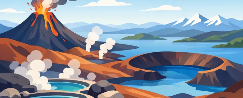
A few minutes apart, the ground around Lake Mývatn can look entirely different: a field of black lava, a green crater, boiling mud, or a lake scattered with small islands. This guide to Myvatn volcanic landscapes helps you make sense of those changes and plan a day that feels unhurried rather than like a race between parking lots.
This is not a landscape that reveals itself all at once. Mývatn is best experienced by slowing down, looking closely, and understanding that the same forces that made the scenery so dramatic are still active beneath your feet.
Why Mývatn Looks Like Nowhere Else
The Lake Mývatn area sits within Iceland’s active volcanic zone. Its present shape comes largely from eruptions, fissures, lava flows, and interactions between molten rock and groundwater. That last detail matters. When rising magma met water, it created explosive steam-driven eruptions that formed many of the craters and unusual landforms visitors see today.
The lake itself is part of the story, not simply a scenic stop between attractions. It is shallow and rich in birdlife, with lava formations and pseudocraters along its shores. In summer, the contrast can be striking: soft green grass and blue water beside dark, rough volcanic rock. In winter, snow simplifies the colors but makes the shapes of craters, lava walls, and steam columns even clearer.
Having grown up near Lake Mývatn, I still find that weather changes the character of the area more than most visitors expect. A bright morning makes the colors feel open and gentle. Low cloud and wind can make the same terrain look raw, ancient, and almost lunar. Neither is better. It depends on what you hope to feel and photograph.
A Practical Guide to Myvatn Volcanic Landscapes
The most rewarding way to see Mývatn is to group places by geology and location, rather than trying to fit every well-known stop into one day. The roads are manageable in good conditions, but each site asks for time on foot. A private day gives you room to adjust for rain, wind, road conditions, daylight, or simply a place you want to stay longer.
Start with the craters at Skútustaðagígar
The grassy formations at Skútustaðagígar are pseudocraters, also called rootless cones. They were not formed by magma erupting directly from a vent beneath them. Instead, lava flowed over wet ground and shallow water, trapping steam that exploded upward through the lava. The result is a cluster of rounded craters beside the lake.
This is a good first stop because it explains an essential Mývatn theme: water and fire working together. The walking is relatively gentle, and the views help orient you to the lake and surrounding volcanic terrain. Keep to the paths, especially in wet weather. The soil and vegetation are fragile, and shortcuts quickly become scars that remain visible for years.
Walk the lava at Dimmuborgir
Dimmuborgir is often described as a lava field, but that undersells it. Its towers, arches, walls, and hollow formations were created when a lava lake drained away, leaving parts of its crust and channels behind. Walking there can feel like entering a ruined stone city, although every shape was made by heat and movement rather than by human hands.
Several marked paths make Dimmuborgir accessible for different energy levels. The shorter routes work well for families or travelers who prefer an easier walk. Longer trails offer more quiet and more time among the formations. If mobility is a concern, it is worth planning the route carefully instead of assuming every trail has the same surface.
Dimmuborgir also carries a place in Icelandic folklore. Around Christmas, the Icelandic Yule Lads are traditionally said to live here. It is a playful story, but it gives the site another layer. In Mývatn, geology and storytelling often share the same ground.
Feel the heat at Hverir
At Hverir, near Námafjall, the landscape is alive in a more immediate way. Steam rises from vents. Mud pots bubble. Sulfur deposits color the ground yellow, white, gray, and rust red. The smell is hydrogen sulfide, often compared to eggs, and it is a reliable reminder that this is an active geothermal area, not a display built for visitors.
Stay on the marked paths here without exception. The thin-looking crust beside a trail can conceal dangerously hot ground, and geothermal conditions can change. Do not test puddles, step over ropes, or let children wander ahead. A respectful visit is also a safer visit.
Hverir is especially compelling in wind or light rain, when the steam shifts quickly across the slopes. For photographers, an early or late visit can be useful, but strong wind may make composition difficult. Your camera lens and glasses can also fog quickly near the vents, so keep a clean cloth handy.
Understand the scale at Krafla and Leirhnjúkur
The Krafla area offers a different perspective: broader lava fields, fissures, geothermal power, and evidence of very recent volcanic activity. The Krafla Fires, a sequence of eruptions and rifting events between 1975 and 1984, reshaped parts of this landscape. That is recent history in geological terms, and it gives the area a particular energy.
Leirhnjúkur is one of the best places to see this story on foot. A marked trail crosses ground where black lava, warm steam, and bright mineral colors meet. Some surfaces still hold heat. In places, the landscape looks freshly made, though the eruptions ended decades ago.
The walk is more uneven than the paths at Skútustaðagígar, and weather can make it demanding. Good hiking shoes are useful, even on a summer day. If fog rolls in, the route can feel much less obvious, so this is one place where local conditions should guide your plans.
Timing Your Day Around Weather and Light
Mývatn rewards flexible timing. In summer, the long daylight lets you spread stops across the day and avoid the busiest periods at popular sites. Midges can be plentiful around the lake on calm, warm days, particularly from late spring through summer. A head net can make a surprisingly large difference to your comfort.
Autumn brings darker nights, changing colors, and a quieter feeling, but weather becomes less predictable. Winter can be extraordinary for snow-covered lava and Northern Lights, yet daylight is limited and driving conditions may be challenging. Some trails can be icy or partly obscured by snow. Spring is often a transition season, with changing road and trail conditions from one week to the next.
For any season, wear layers rather than relying on one heavy coat. Windproof outer clothing, waterproof footwear, gloves, and a warm hat are sensible even when the forecast looks mild. The temperature can feel very different beside an exposed crater than it does in a sheltered parking area.
What a Local Guide Adds
You can certainly visit Mývatn independently, but the trade-off is that you spend more attention on navigation, weather checks, parking, trail choices, and the question of what you are actually seeing. A local guide can connect the sites into one story, adjust the route when conditions change, and make space for quieter viewpoints that suit your interests.
That can be particularly valuable for photographers, travelers visiting in winter, families with different walking abilities, or anyone who prefers not to drive unfamiliar roads. At Kip, private tours can be shaped around geothermal landscapes, easier walks, birdlife, local history, or the changing light that makes Mývatn so memorable.
The best day here is rarely the one with the most stops. Choose a few places, give yourself enough time to walk, and listen for the quiet sounds between the steam vents and the wind. Mývatn is a landscape made by upheaval, but it is best met with patience.
