
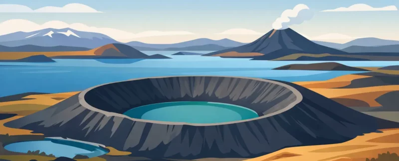
A patch of grass beside Lake Mývatn can look perfectly calm until you notice the rounded cones beneath your feet. The volcanic craters near myvatn are not all what they seem, and that is part of what makes this area so memorable. Some were built by eruptions. Others formed when molten lava met wet ground and exploded in steam. A few minutes apart by road, you can move from gentle lakeside paths to black lava country that feels newly made.
For visitors, the challenge is not finding volcanic scenery here. It is choosing where to slow down. The Mývatn area has a great deal packed into a small region, and each crater site tells a different chapter of the same restless geological story.
Volcanic Craters Near Myvatn: Know What You Are Seeing
Mývatn sits within one of Iceland’s most active volcanic zones. The landscape has been shaped by repeated eruptions, fissures, lava flows, earthquakes, and water over thousands of years. It is tempting to call every cone or hole in the ground a crater, but the local geology is more interesting than that shortcut.
The famous formations at Skútustaðagígar, on the south side of Lake Mývatn, are pseudocraters. No magma rose through these particular mounds. Instead, a lava flow crossed waterlogged ground about 2,300 years ago. Steam became trapped below the lava, pressure built, and explosions formed the low, circular cones seen today. They are sometimes called rootless cones because they are not connected to a volcanic vent below.
At Hverfjall, the story is different. This is a true tephra crater, a huge black ring formed by a powerful eruption roughly 2,500 years ago. Its scale can be hard to understand from the parking area. Once you climb to the rim, the crater stretches out like an enormous bowl, with lava fields, mountains, and Lake Mývatn visible beyond it when conditions are clear.
Then there is Dimmuborgir, where lava created towers, caves, arches, and twisted walls rather than one neat crater. It belongs on a crater-focused day because it shows what happened after eruptions: lava moved, cooled, drained, and left a strange architecture behind.
Start With the Landscape That Fits Your Day
Skútustaðagígar is the most accessible choice for travelers who want an easy introduction. Walking paths loop through grassy pseudocraters with views over the lake, wetlands, and distant mountains. It works especially well for families, travelers with limited time, or anyone arriving after a long drive. The ground can still be uneven and wet, so sturdy shoes are useful, but this is not a demanding hike.
The atmosphere changes with the light. On a bright summer evening, the lake and green cones can look almost gentle. In rain, wind, or low cloud, the same place feels more elemental. Birdlife is another reason not to rush through. Mývatn means “midge lake,” and while the small insects can be annoying at times in summer, the wetland habitat supports a remarkable number of birds.
Hverfjall asks more of you. The climb to the rim is short but steep, exposed, and often windy. Loose volcanic gravel makes the descent feel harder on the knees than the ascent. It is worth it for travelers who can manage the walk and want the clearest sense of the region’s volcanic force.
There are designated routes onto the rim for a reason. The crater’s dark ash slopes are fragile, and footsteps outside the paths leave scars that can remain visible for years. A good visit is not about reaching every possible viewpoint. It is about taking the time to absorb the scale without damaging the place.
Hverir Is Not a Crater, but Do Not Skip It
Námaskarð, commonly called Hverir, is one of the stops people remember most strongly. It is a geothermal area of bubbling mud pots, hissing steam vents, mineral-stained ground, and a very noticeable sulfur smell. It is not a crater site, but it explains the heat still moving beneath the wider Mývatn landscape.
The colors here can be extraordinary: rust red, yellow, gray, and pale blue-gray against black earth. They are also a reminder that the surface is unstable. Stay on marked paths, keep children close, and never test the ground around a mud pot or steam vent. Geothermal water and mud can cause severe burns, even where the earth looks dry.
For photographers, Hverir and Hverfjall make a strong contrast on the same day. One is alive with steam and color; the other is spare, black, and quiet. Weather determines the experience. Low cloud can make Hverir dramatic but hide the views from Hverfjall. On a clear day, the crater rim may deserve more time.
Dimmuborgir Shows Lava in a Different Form
Dimmuborgir is often described as a lava fortress, which is fair enough once you see its rock formations. A large lava pond once stood here. As it cooled and drained, it left pillars, caves, and walls behind. The marked trails range from brief and easy walks to longer routes, making it a flexible stop for different energy levels.
This is also a place where local stories have taken hold. Icelandic folklore connects Dimmuborgir with the Yule Lads, the mischievous holiday figures who visit children in the days before Christmas. The geology is real, but the stories add another layer to a landscape that already looks like it belongs in a saga.
If you have only a short time, choose one route and walk it slowly instead of trying to cover every trail. The best details are often close by: the rough texture of the lava, moss growing in sheltered cracks, and the way a formation changes shape as you pass it.
Plan Around Weather, Crowds, and Your Own Pace
The crater areas around Mývatn are close together, but a satisfying day needs room for weather and stops that take longer than expected. Wind can be the deciding factor at Hverfjall. Rain can make paths slick. In winter, daylight is limited and conditions may change quickly, while snow and ice can hide uneven surfaces.
Summer brings long evenings and more flexibility, but also more visitors at the best-known sites. Going early or later in the day usually offers a quieter experience and softer light. The midges are most likely to matter on still, warm days near the lake. A head net can be a very sensible item to carry, even if you never need it.
Driving is straightforward in good conditions, but it depends on the season and your confidence on Icelandic roads. Do not treat a crater visit as a reason to stop wherever a view appears. Use proper parking areas, watch for sheep, and allow extra time when roads are wet, icy, or affected by wind.
A private day with a local guide can make the route feel less like a checklist. At Kip, I can adjust the order of stops for cloud cover, wind direction, walking ability, bird interest, or photography light. Just as importantly, there is time to explain why one round hill is a pseudocrater while another is the result of an explosive eruption.
A Few Respectful Habits Make a Real Difference
These landscapes have endured volcanic eruptions, but they are surprisingly vulnerable to visitors. Moss grows slowly, ash slopes erode easily, and geothermal ground is dangerous in ways that are not always obvious. Stay on paths, take your trash with you, and resist the urge to build rock piles or take stones home.
Dress for a change in weather even on a short walk. Waterproof outer layers, warm layers, gloves, and shoes with a good grip are useful in every season. Bring water and a snack for longer outings, particularly if you are walking Hverfjall or combining several sites. There are facilities near some major stops, but not everywhere you might want to pause.
The real pleasure of the Mývatn craters is that they reward attention. Stand on Hverfjall’s rim long enough for the wind to quiet in your ears. Look across the green pseudocraters toward the lake and picture lava moving over water. The landscape is not just dramatic because it is volcanic. It is dramatic because the evidence of change is still so clear.
