
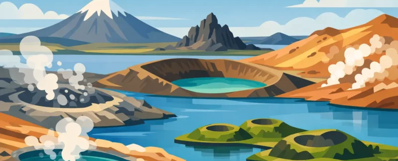
Lake Mývatn is not a place where geology sits politely behind a rope. It is under your feet, in the steam drifting across the road, and in the dark lava walls that make even a short walk feel otherworldly. The best Myvatn geology stops tell one connected story: eruptions, lava flows, groundwater, and the powerful forces still moving beneath this part of North Iceland.
The area is compact on a map, but it deserves more than a rushed circuit between parking lots. Some sites reward a ten-minute stop; others need time to walk, look closely, and understand what happened here. Weather, road conditions, mobility, and your interest in hiking all affect the best order of the day.
1. Skútustaðagígar Pseudocraters
At the southern edge of Lake Mývatn, the rounded craters at Skútustaðagígar are an excellent starting point because they explain a key feature of the landscape. They are not true volcanic craters. About 2,300 years ago, hot lava flowed over wet ground and shallow water. Steam explosions punched holes through the cooling lava, building the crater-like forms seen today.
A gentle path crosses the area, with wide views over the lake, wetlands, and surrounding volcanic hills. This is a particularly good stop for families, travelers easing into a day of walking, and photographers working in soft early or late light. Please stay on the marked trails. The ground here is fragile, and the birdlife around the lake needs room as well.
2. Dimmuborgir Lava Formations
Dimmuborgir means “dark castles,” which is a fair description when you first see its towers, arches, and twisted lava walls. The formations were created when a large lava flow spread across a wet landscape. In places, the outer lava cooled while molten material beneath it drained away, leaving caves, pillars, and strange hollow structures behind.
There are several marked walking routes, so Dimmuborgir can be as easy or as active as you want it to be. The shorter paths suit a relaxed itinerary, while longer loops provide more quiet and better chances to see the lava forms without a crowd. It is also one of the places where geology and Icelandic folklore naturally meet: the landscape looks exactly like the sort of place where stories would take root.
3. Hverfjall, the Black Tuff Ring
Hverfjall is one of the most memorable sights in the Mývatn area: a vast, nearly symmetrical black crater rising above the lava fields. It formed in a powerful explosive eruption roughly 2,500 years ago, when magma met water and fragmented into fine volcanic ash. The result is a tuff ring, built mainly from compacted ash rather than solid lava.
The hike to the rim is short but steep, and the wind can be serious even on a calm-looking day near the lake. Once on top, the scale becomes clear. You can look into the broad crater on one side and across Mývatn, Dimmuborgir, and distant highlands on the other.
This is not the right stop for everyone. Loose gravel, wind, and uneven footing can make it uncomfortable for those with limited mobility. But for travelers able to manage the climb, Hverfjall gives one of the clearest views of how volcanism shaped the entire district.
4. Grjótagjá Fissure Cave
Grjótagjá is a small lava cave with a geothermal spring below it. Its blue water is beautiful, but this is a place for looking, not bathing. Water temperature can change quickly and can be dangerously hot, so swimming is not permitted or sensible.
Geologically, the cave sits within a fissure system. Cracks in the Earth’s crust allow groundwater to circulate downward, heat up near hot rock, and return toward the surface. The cave is a useful reminder that the Mývatn area is not just a record of old eruptions. It remains geothermally active.
This is a brief stop and can feel crowded at busy times. I usually think of it as a worthwhile addition between larger sites rather than the centerpiece of a day. Visitors should take extra care on the stairs and around the entrance, especially in wet or icy conditions.
5. Hverir Geothermal Area
At Hverir, near Námafjall, the ground hisses, bubbles, and smells strongly of sulfur. Mud pots pop and churn, steam vents rise from the slopes, and mineral-rich earth appears in shades of ocher, gray, red, and yellow. If you are traveling with someone who has never seen active geothermal ground, this is often the stop that makes Iceland’s volcanic energy feel most immediate.
The color comes from minerals altered by heat and acidic gases. The smell is hydrogen sulfide – the familiar “rotten egg” scent of geothermal areas. It is not everyone’s favorite perfume, but it is part of the experience.
Stay on the marked paths here without exception. Thin ground and boiling water are real hazards, not dramatic scenery for a photo. Hverir is easy to access, but a good guide can add context about what you are seeing and choose the best timing when wind or weather makes the area more pleasant.
6. Leirhnjúkur and the Krafla Fires Landscape
For a closer look at Iceland’s recent volcanic history, walk the trail at Leirhnjúkur in the Krafla area. The landscape was heavily affected by the Krafla Fires, a series of eruptions and rifting events between 1975 and 1984. Fresh-looking lava, steaming cracks, and colorful mineral deposits make the ground feel surprisingly young because, in geological terms, it is.
The route passes through a mix of rough lava and geothermal terrain before reaching the warm, fractured slopes around Leirhnjúkur. Steam can rise directly from cracks in the lava, particularly in cool weather. This is one of the best places to understand that Iceland sits on an active plate boundary, where the North American and Eurasian plates are gradually pulling apart.
Allow enough time for this stop. The walk is not extreme, but the uneven lava calls for sturdy footwear and careful attention. Snow, ice, or strong wind can change the experience considerably outside summer, and conditions should guide the plan.
7. Víti Crater at Krafla
Víti, meaning “hell,” is an explosion crater formed during the Mývatn Fires of the early 18th century. Its milky blue-green water and sharply cut crater walls make it visually very different from Hverfjall’s wide black bowl. The color of the water comes from minerals and suspended particles, while its temperature varies with geothermal activity.
A road brings visitors close to the crater, making it a useful geology stop for travelers who want a dramatic view without a long hike. The path around the rim can be muddy, icy, or slippery, however, and the steep sides are a good reason to keep children close. A quick look from the safest viewpoint is often enough when conditions are poor.
8. Krafla Lava Fields and Power Landscape
Around Krafla, geothermal energy and volcanic terrain exist side by side. Roads cross dark lava fields, steam rises from the hills, and the area’s power infrastructure makes visible use of the heat below ground. This is a good place to talk about the practical side of Icelandic geology: volcanoes bring risk, but geothermal heat also supports homes, greenhouses, and electricity production.
It is an interesting contrast to the untouched feeling of other Mývatn sites. The infrastructure is not a distraction if you know what you are looking at. It shows how Icelanders have learned to live with a restless landscape rather than treating it as a distant wilderness.
9. Höfði and the Lake’s Lava Shoreline
Höfði is a quieter final stop on the eastern side of Lake Mývatn. A small wooded area leads to lava formations along the water, including natural arches and pillars created by the same volcanic processes that shaped much of the lake basin. The setting is gentler than Hverir or Krafla, but the geology is still present in every dark rock outcrop.
This is a fine place to slow down after the bigger sights. The paths are generally easy, and the views across the lake bring the day’s story together: lava met water, explosions formed craters, and life returned to the volcanic ground.
How to Plan the Best Myvatn Geology Stops
Trying to see all nine stops in a short summer afternoon usually means seeing none of them properly. For a full day, a sensible route often begins around the lake at Skútustaðagígar, continues through Dimmuborgir and Hverfjall, then heads east toward Hverir and Krafla. Höfði works well when you want a quieter break, while Grjótagjá is easy to fit between stops.
In winter, daylight and road conditions matter more than a perfect route. In summer, the trade-off is between fitting in every highlight and allowing time for walks, photographs, and the unexpected conversation that makes a place memorable. Bring layers, windproof outerwear, water, and footwear with grip in every season. The ground can be uneven, muddy, hot, icy, or all four within a few miles.
The real pleasure of Mývatn is that the sites are not isolated attractions. Each crater, lava field, and steam vent helps explain the next one. Give the landscape time, ask questions, and let the route flex with the weather. That is usually when North Iceland begins to feel less like a checklist and more like a place you have genuinely come to know.